


From Greenland to Sardinia: Testing Ocean Salinity from Space
- Post by: AntoninoIan Ferola
- June 25, 2026
From Greenland to Sardinia: Testing Ocean Salinity from Space
A recent study evaluated how well satellite observations can reproduce sea surface salinity across very different oceanographic regions, from the cold and freshwater-influenced waters near Greenland to the highly saline western Mediterranean Sea.
Sea surface salinity is a key climate variable because it reflects exchanges of freshwater between the ocean, atmosphere, sea ice and continental margins. It also contributes to ocean density, circulation and water-mass formation. However, measuring salinity from space remains challenging, especially in high-latitude and coastal regions.
In this study, several satellite-derived sea surface salinity products were compared with independent in situ measurements collected during a ship transect from western Greenland to Sardinia in fall 2021. The route crossed approximately 4000 nautical miles and sampled contrasting regimes, including the subpolar North Atlantic, the central Atlantic, the Strait of Gibraltar and the western Mediterranean Sea.
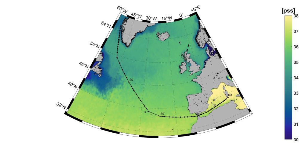
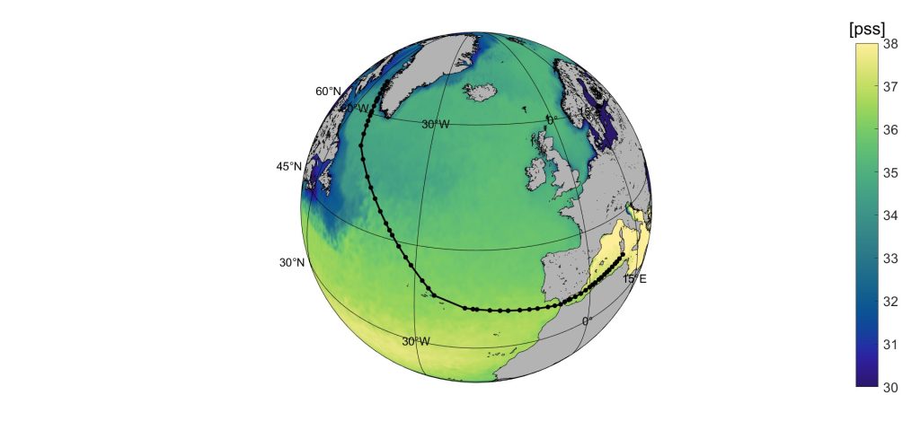
Figure 1. Ship route from western Greenland to Sardinia, with sampling stations superimposed on the fall sea surface salinity climatology. The transect provides a unique pathway across contrasting oceanic regimes, from low-salinity high-latitude waters to the saltier Mediterranean Sea.
The results show that satellite products successfully capture the large-scale increase in salinity along the transect. However, their performance is strongly region-dependent. The largest discrepancies occur near Greenland and in coastal or semi-enclosed regions such as the Strait of Gibraltar and the western Mediterranean, where land contamination, sharp salinity gradients and small-scale dynamics make satellite retrievals more difficult.
Among the tested products, global multi-mission and optimally interpolated datasets generally showed the most stable agreement with in situ observations. Single-mission products displayed larger and more variable differences in challenging regions. A simple multi-product ensemble also reduced product-specific noise and provided a balanced representation of salinity variability across the full transect.
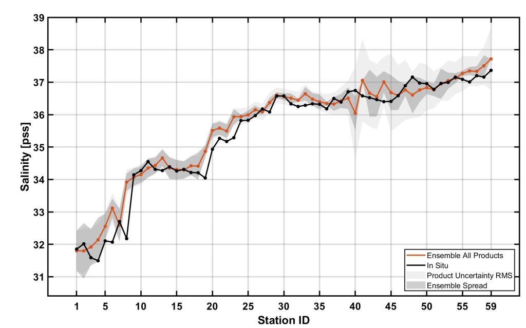
Figure 2. Comparison between in situ salinity measurements and the satellite ensemble estimate along the ship transect. The ensemble approach reduces product-specific variability and provides a more robust large-scale representation of sea surface salinity.
These findings highlight the value of combining satellite observations with independent field measurements. Satellites provide the broad spatial view needed for climate and ocean monitoring, while in situ data remain essential to identify where satellite products perform well and where further algorithmic development is needed.
Reference:
Ferola, A. I., Sabia, R., Cotroneo, Y., Cesarano, C., Olmedo, E., González-Gambau, V., Wadhams, P., & Aulicino, G. (2026). Comparing Sea Surface Salinity Variability from Spaceborne and In Situ Data: The North Atlantic and Western Mediterranean in Fall 2021. Remote Sensing, 18(5), 797.
For further details, refer to the full paper: https://doi.org/10.3390/rs18050797