
Hazards
A 25-year assessment of Hot and Dry Weather Compound events in Europe using Earth Observation
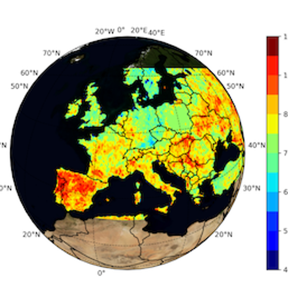
Hot and Dry Weather Compound events (HDCEs) represent an emerging domain in meteorology,...
Carbon
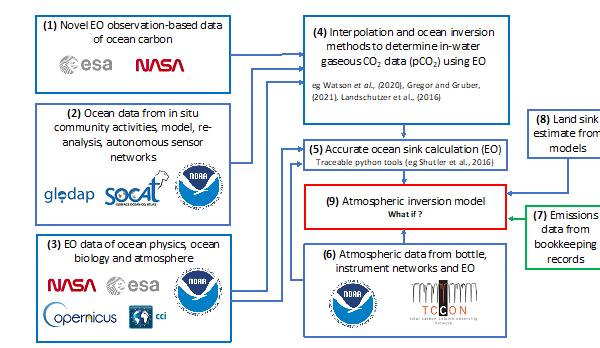
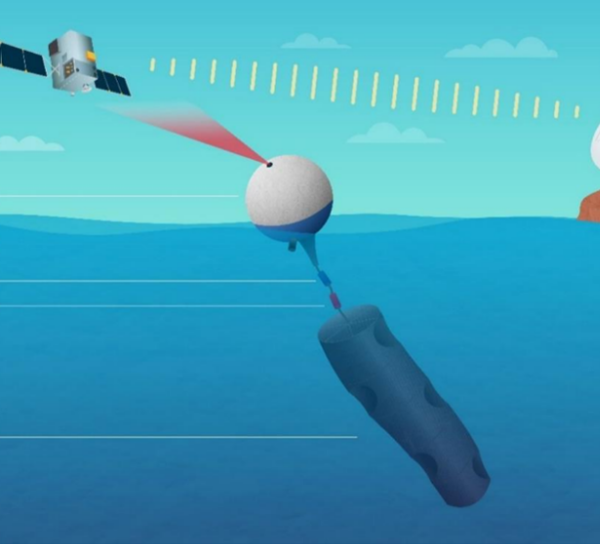
Actively demonstrating the value and importance of estimating the ocean carbon sink
Jamie D. Shutler, Professor of Earth observation and climate, University of Exeter, UK, Visit: June...
Oceans
Assessment of renewable wave energy resources in the coastal zone using high-resolution altimetry products
OCRE EO project. European Commission, HORIZON 2020 program (November 2022-November 2023), Project...

Atmosphere
Combined EarthCARE–Geostationary lightning observations of convective storms
Blanka Piskala Gvoždíková, Dr, Internal research fellow @ the Esrin Science Hub Introduction...
Cryosphere
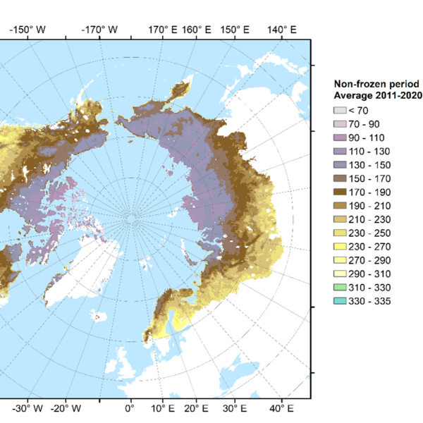
CryoBioLinks: Assessing cryosphere-biosphere linkages with Earth Observations in northern high latitudes
Kristin Böttcher, 1.11.2024 Climate warming in the northern high-latitudes has consequences for...
Developing a Machine Learning Framework for 1-km High-Resolution Satellite Precipitation Estimation
Satellite-based precipitation estimation offers a valuable alternative to ground-based measurements...
Biosphere
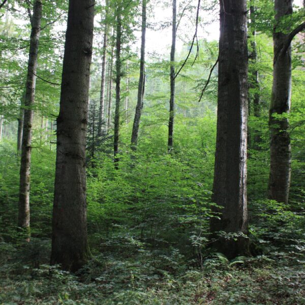
Exploring resilience dynamics of European forests after drought and compound hot and dry extreme events
Agata Elia, Dr, Internal Research Fellow @ Esrin Science Hub The increase in the frequency of...
Biosphere
Hyperspectral and multispectral data fusion for monitoring biodiversity
The increasing number of hyperspectral sensors have opened the path to more widespread application...

Oceans
Medicane characteristics from high-resolution satellite radar observations
Arthur Avenas, Dr, Internal Research Fellow @ ESRIN Science Hub This research project focuses on...
Oceans
Ocean carbon from space and in synergy with autonomous platforms
Visiting Scientist Dr. Marco Bellacicco (CNR-ISMAR, Rome) Period: June 2022 – June 2024 Tasks:...
Land
Polarimetry and SAR dynamical processes
As a visiting scientist at the Science Hub, my research centers on advanced radar image analysis,...
Oceans
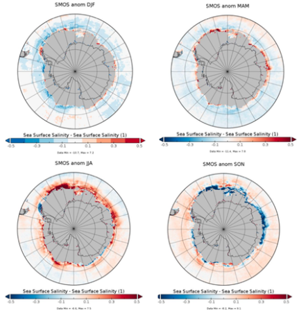
Southern Ocean Freshwater (SO-FRESH)
Dr. Alessandro Silvano, visiting scientist, March 2024 – August 2024 The Southern Ocean...
Oceans
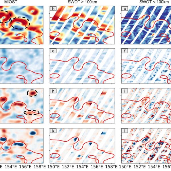
SWOT’s new observational capacity at the ocean surface fine scales enables the reconstruction of precise vertical dynamics
Dr Elisa Carli, Internal Research Fellow @Esrin Science Hub The Surface Water and Ocean Topography...
Land
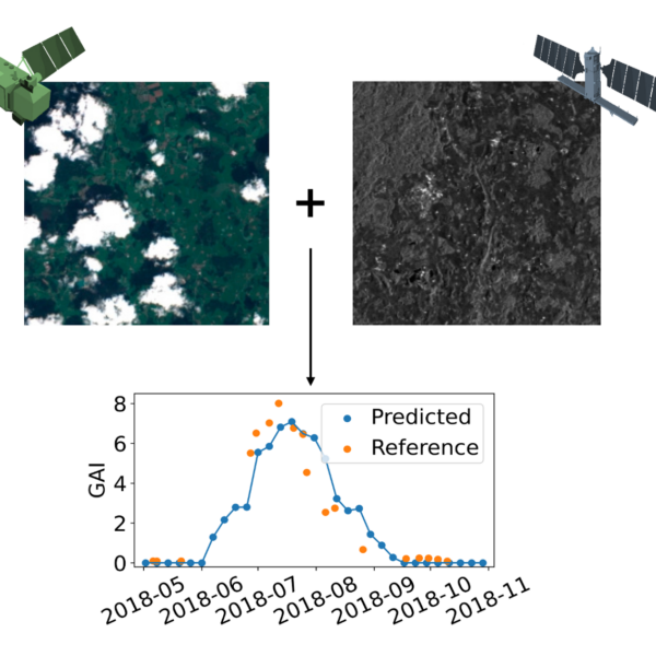
Synergistic use of optical and SAR data for the retrieval of essential climate and agricultural variables
Earth observation (EO)-based optical vegetation descriptors—such as the leaf area index (LAI),...
Atmosphere
The LISA Project – Atmospheric Waves in Aeolus wind data
Dr. Lisa Küchelbacher, German Aerospace Center (DLR) : Lidar measurements to Identify Streamers...
Atmosphere
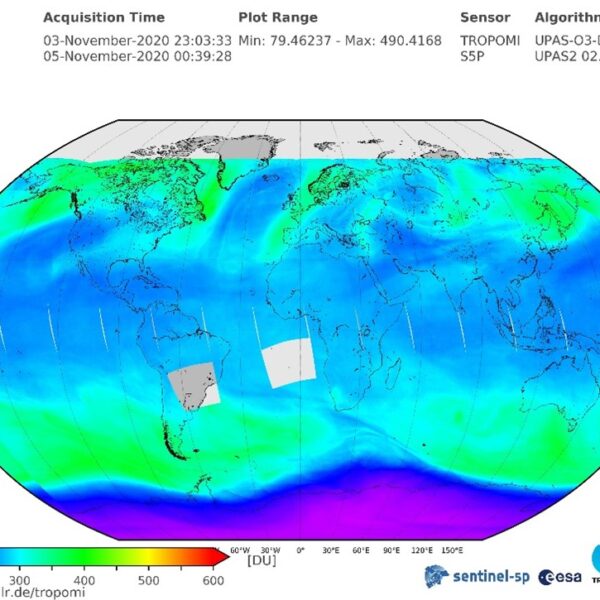
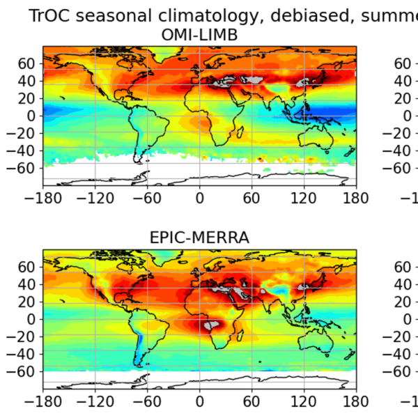
The OREGANO Project – A Focus on Tropospheric Ozone and its Long-term Trends
The Ozone Recovery from Merged Observational Data and Model Analysis (OREGANO) project has the aim...
Cryosphere
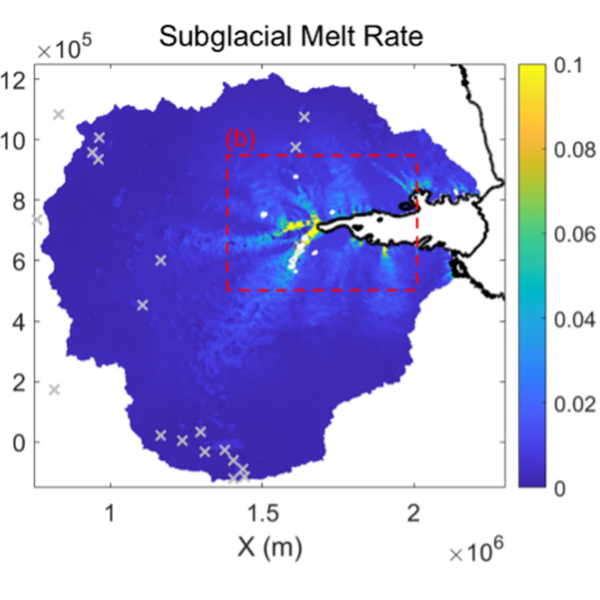
Using satellite altimetry and numerical modelling to characterise subglacial hydrology beneath the Antarctic Ice Sheet
Melting beneath the Antarctic Ice Sheet is relatively low, but the pattern of melting and meltwater...
Oceans
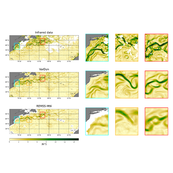
VarDyn: Dynamical joint-reconstructions of Sea Surface Height and Temperature from multi-sensor satellite observations
Objectives The use of satellite data has revolutionized the study of upper ocean dynamics, offering...