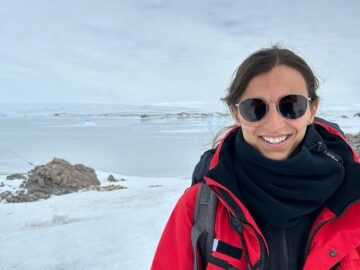
Elisa Carli
Internal Research Fellow
Biography
I am an aerospace engineer with a strong passion for environmental sciences. I began my career as a YGT (young graduate trainee) at the European Space Agency where I worked on the implementation of innovative radar architectures. Driven by a growing interest in Earth System sciences, I transitioned to the study of ocean physics pursuing a PhD in Remote Sensing Physical Oceanography at the Laboratoire d’Etudes en Geophysique et Oceanographie Spatiales (LEGOS) in Toulouse (France). My doctoral research, funded by the Centre National d’Etudes Spatiales (CNES) and Collecte Localisation Satellites (CLS), focused on the study of Southern Ocean dynamics using data from the Surface Water and Ocean Topography (SWOT) satellite mission. This work involved extensive international collaborations with research groups in San Diego (USA), Hobart (Australia) and Gothenburg (Sweden) as well as participation in a field campaign in the Southern Ocean to collect in-situ data for validation purposes. In 2024, after completing my PhD, I joined the Science Hub as an Internal Research Fellow, where I continue to integrate space technology and ocean science to advance our understanding of the global climate system.
Research
My research is part of a broad effort of the oceanographic community to better understand the role of the ocean as a mitigator for climate change. I focus on the observation and analysis of ocean structures (eddies, fronts) between 20 and 150 km of diameter in the Southern Ocean with satellite altimetry, model simulations and in-situ data. Particularly, I am investigating the best methodologies to reconstruct the vertical currents in the water column from the surface fields observed by satellite altimeters. The aim is to evaluate in which locations the Southern Ocean acts as a source or sink of heat and carbon. I got interested in this topic because vertical currents move heat, carbon, nutrients and other tracers, but we cannot directly measure these quantities everywhere, at all times. Finding a way to accurately access this information from satellite observations will allow us to evaluate the most vulnerable, productive or active regions in order to improve climate models and protect our ocean.
Projects: The Surface Water and Ocean Topography (SWOT) – ESA Science Hub


