
Assessment of renewable wave energy resources in the coastal zone using high-resolution altimetry products
- Project by: Science Hub Team
- August 22, 2024
OCRE EO project. European Commission, HORIZON 2020 program (November 2022-November 2023), Project Manager OCRE EO Earth Observation grant project entitled: OCRE EO “Assessment of renewable wave energy resources in the coastal zone using high-resolution altimetry products”. Budget: 200k. Consortium: Earth Console and CENTEC-Instituto Superior Tecnico de Lisboa.
Method
More than a decade of processed CryoSat-2 and Sentinel-3A/B data over coastal zones are now available in the ESA Altimetry Virtual Lab hosted on EarthConsole®.
This is the result of the European Commission OCRE (Open Clouds for Research Environments) financed project, led by the PI Sonia Ponce de León Álvarez from CENTEC (Centre for Marine Technology and Ocean Engineering) – Instituto Superior Técnico de Lisboa and member of the ESA Altimetry Virtual Lab, with the support of EarthConsole®, https://earthconsole.eu/virtual-labs/the-altimetry-virtual-lab/.
The project aimed at evaluating renewable wave energy resources in the coastal zone, employing advanced high-resolution altimetry products.
For this study our processing covered coastal zones and an extensive period of 11 years (from January 2011 to December 2022) for CryoSat-2 data and 7 years (from April 2016 to December 2022) for Sentinel-3 data. The processing was conducted using the ESA-ESRIN SARvatore services for CryoSat-2 and Sentinel-3, and the enhanced geophysical retrieval algorithm known as SAMOSA+ model and retracker.
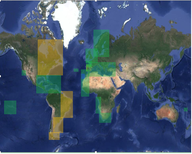
The areas of interest processed for this project are delineated in Figure 1. Green areas represent processing with both CryoSat-2 and Sentinel-3 data, yellow areas are exclusively related to CryoSat-2 data, and blue areas represent processing with Sentinel-3 data. The empirical model of Gommenginger et al. (2003) is applied to estimate the wave period from the Ku-band radar altimeter significant wave height (Hs) and the radar backscatter coefficient (𝜎0) using the new database mentioned above.
Results
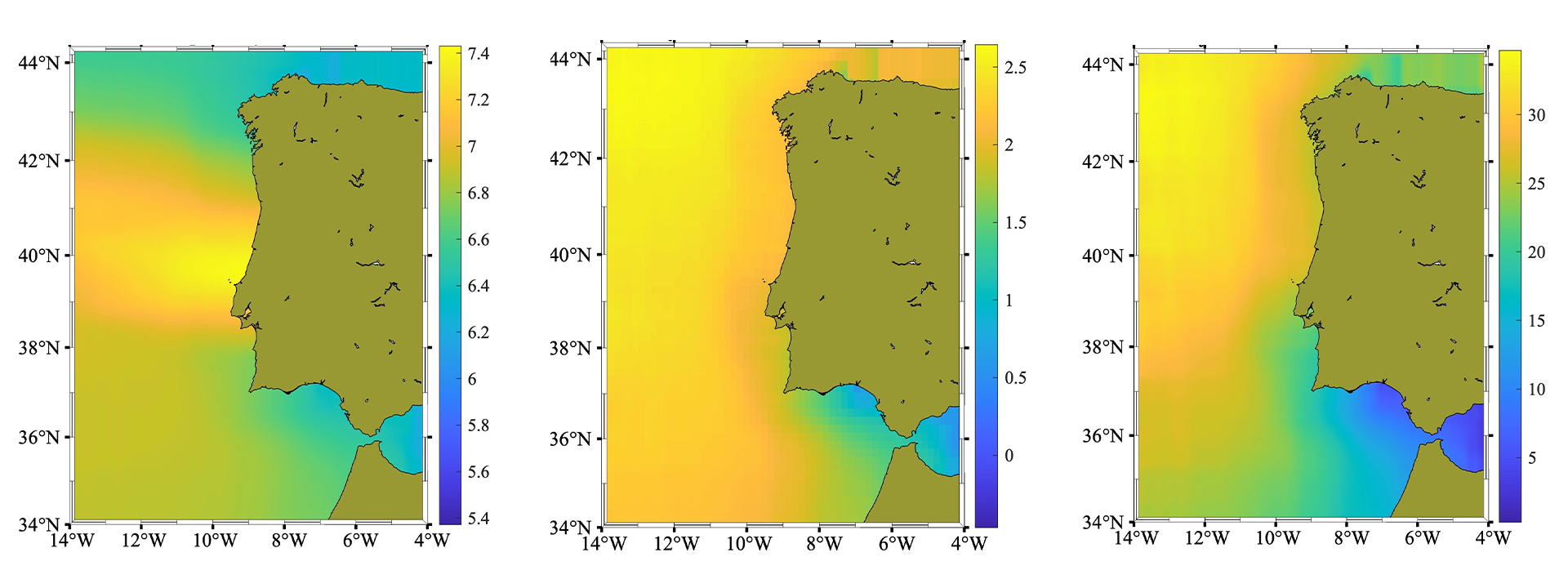
Using the created database, we are producing key information from ocean waves that will be useful for companies that are operating nearshore cropping energy from waves. Figure 2 shows the average maps of the wave period (left), the significant wave height (middle) and the wave power density (right) maps in the West side of the Iberian Peninsula.
Publications
- 2024, Ponce de León, S.; Restano, M.; Benveniste, J. Assessing the Wave Power Density in the Atlantic French Façade from High-Resolution CryoSat-2 SAR Altimetry Data. Energy, ELSEVIER, 131712, ISSN 0360-5442, https://doi.org/10.1016/j.energy.2024.131712
- 2024, Ponce de León S., J.H. Bettencourt, J. V. Ringwood, J. Benveniste. Assessment of combined wind and wave energy in European coastal waters using satellite altimetry. Applied Ocean Research, Volume 152,104184, ISSN 0141-1187, https://doi.org/10.1016/j.apor.2024.104184
- 2023, Ponce de León, S.; Restano, M.; Benveniste, J. Assessment of Wave Power Density Using Sea State Climate Change Initiative Database in the French Façade. J. Mar. Sci. Eng. 2023,11,1970, https://doi.org/10.3390/jmse11101970
Code
Data is available at the Altimetry Vitual Lab repository:
https://avl-repo.earthconsole.eu/sarvatore/CENTEC_OCRE
This research was carried out by Dr Sonia Ponce de León.